- Suresh Kumar
- 10-04-2025
- 0 Comments
Decoding the Andaman Islands: A Guide to Geographical Location and Maps
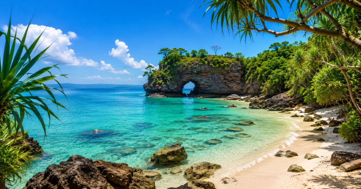
The Geographical location of Andaman and Nicobar island Islands stand within the Bay of Bengal as an island archipelago that impresses visitors with its sandy beaches water clarity and tropical forests. The island chain forms an exotic location containing more than 500 islands which provides perfect enchantment for outdoor enthusiasts and cultural history buffs. At Radhanagar Beach visitors can relax on white sandy shores while Havelock Island exposes them to its alive coral ecosystems.
Port Blair stands as a historical landmark because it features the infamous Cellular Jail which reminds India about its colonial period. Visitors can find endless excitement to explore during their stay at the Andaman Islands because these tropical islands let people swim through azure waters with marine life discoveries and hike through lush rainforests while experiencing peaceful island relaxation.
Geographical Location of Andaman And Nicobar Land
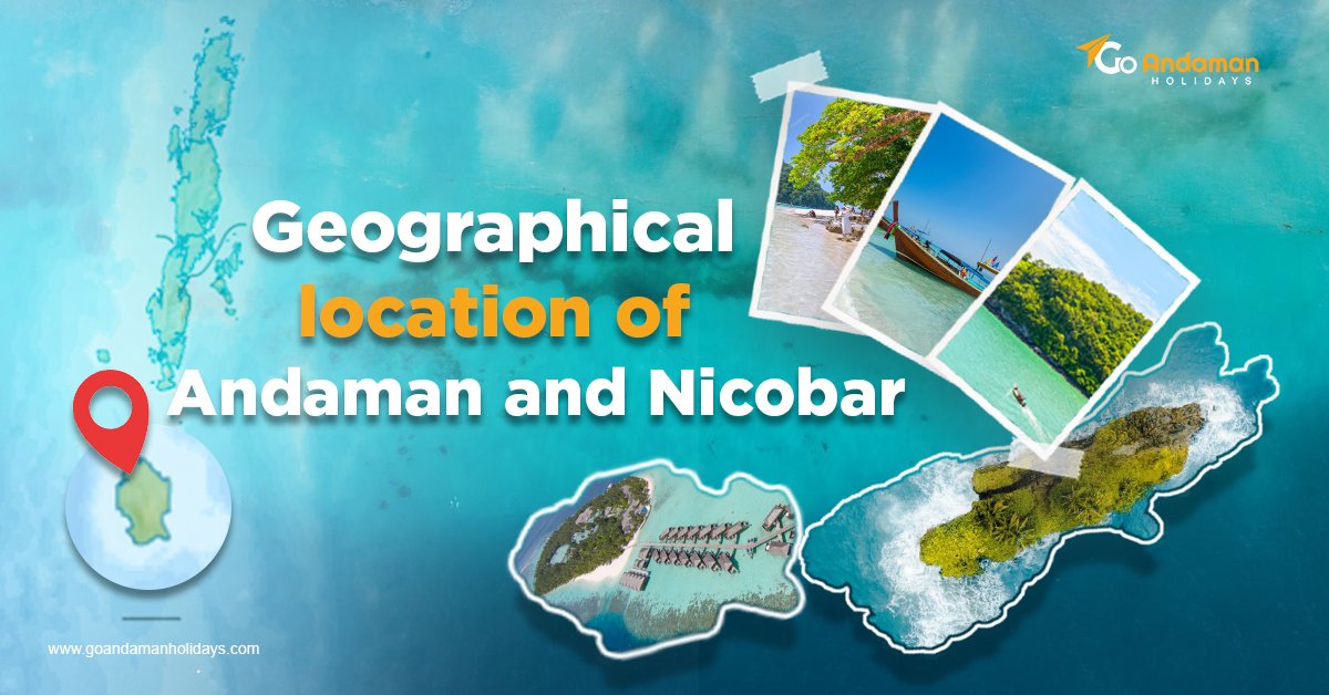
The Andaman Islands form a part of another group of islands, the geographical location of Andaman and Nicobar Islands, which are one of the Union Territories of India. In other words, it is located in the southeastern part of the Bay of Bengal, being nearer to Myanmar and Thailand than to the mainland of India.
Latitude and Longitude: The archipelago lies between 10°N and 14°N latitude and 92°E to 94°E longitude.
Distance from Mainland India: The Andaman Islands, located at a distance of 1200 km (746 miles) from Kolkata and 1190 km (739 miles) from Chennai.
Proximity to Other Countries: Being 190 km from Myanmar, 450 km from Thailand, and 500 km from Indonesia, they have their geopolitical importance.
Click here:- Andaman Honeymoon Package
Geophysical Geography And Topography
The geographical location of the Andaman Islands consists of nearly 300 islands, of which only a few are inhabited. They have:
Mountainous terrain and forests, developed as an extension of the Arakan Yoma range in Myanmar.
Volcanic islands, include Barren Island, which is India’s only active volcano.
Coral reefs and marine ecosystems, nurture a variety of marine life.
Mapping Of The Andaman Islands
Nature of Maps Available
The Andaman Islands may be viewed from different perspectives depending on the following maps:
Political maps: These represent an administrative division distinguished by certain characteristics such as major islands found in North Andaman, Middle Andaman, South Andaman, and Little Andaman.
Physical maps: They show the nature of terrain and mountains or water bodies adjoining the islands.
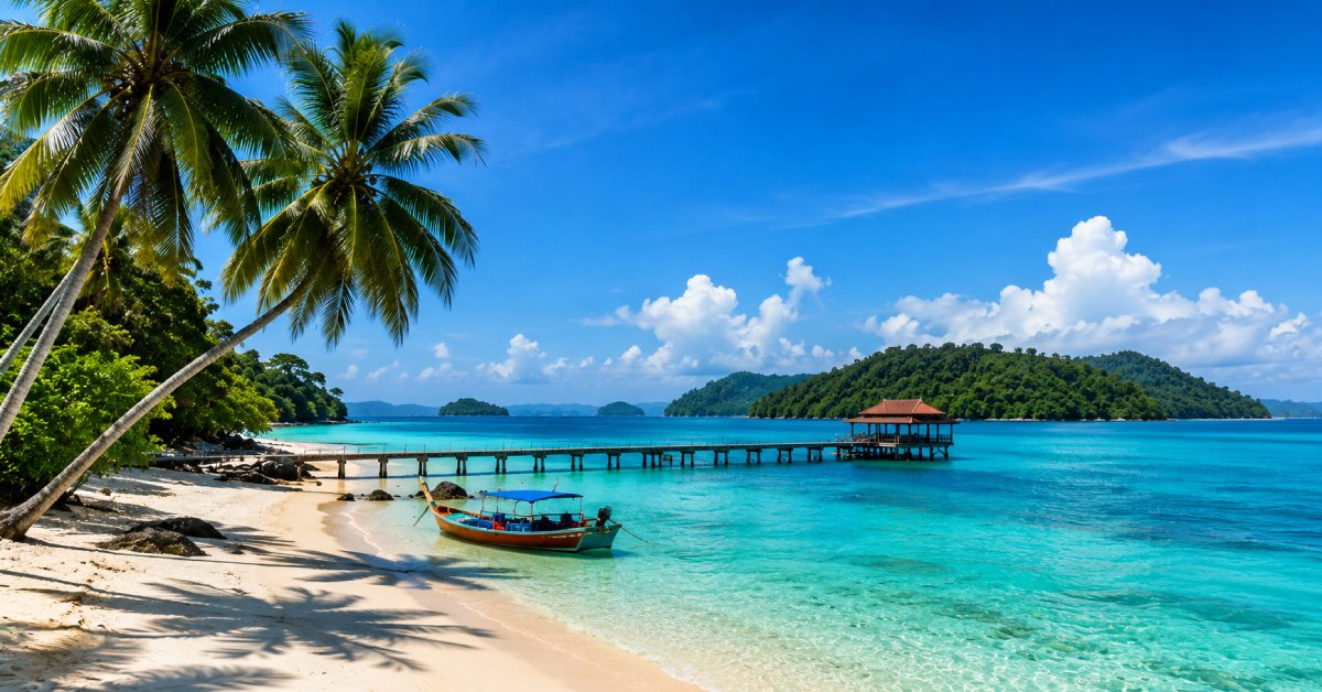
Tourist maps: Maps that indicate attractions like Radhanagar Beach, Cellular Jail, and Ross Island.
Satellite maps: These are useful for research and navigation purposes; they represent real-time imagery of the archipelago.
Navigation and Maritime Maps:
Crucial for shipping and trading activities; these maps identify deep-sea channels and maritime boundaries.
How To Read An Andaman Islands Map?
When studying the map of the Andaman Islands, several factors are vital to understanding the geographical and strategic significance of the island chain.
Scale and Distance
Scaling of the map is important to measure the distance between islands. The Andaman archipelago contains more than 300 islands spread over more or less 700 kilometers (435 miles) from north to south. The distance between the major islands affects the time taken to reach them, and their intra-linking and distantly inter-link will affect the logistics. For example, Port Blair, the capital city, located, focuses on the administration and transport of the region.
Key Landmarks
The Andaman Islands are dotted with landmarks of importance for administration and tourism. Port Blair, the capital city, hosts important government offices, the main airport, and a big naval base. Havelock Island, now called Swaraj Dweep, is another strategic site, known for its beautiful beaches, coral reefs, and active tourism potential. Others are Neil Island, Shaheed Dweep, and North Andaman, which are famous for their biodiversity, indigenous tribes, and ecological importance.
Waterways and Strategic Shipping Routes
The Andaman Islands occupy an important place close to some of the world's busiest routes for maritime trade. The archipelago is located very close to the Malacca Strait, a narrow yet vital passage that is perceived to be handling almost 40% of global trade. Thus, it becomes really very important for international shipping, naval operations, and maritime security. The proximity of the islands to all those major waterways makes them important not only for India's defense strategy but also as a key area for regional maritime surveillance and trade protection.
By looking into these factors, a full understanding of the geographic importance, economic importance, and strategic relevance of the Andaman Islands in national and international affairs can be achieved.
Strategic Importance of Andaman Islands Location
Strategic Importance of the Andaman Islands for India: A Military and Geopolitical Asset in the Indian Ocean Region.
Enhancing India's strength
The Indian Navy extensively uses these islands to increase its defense capability. Host settlements have also a forward-operating base for India, which helps it monitor its maritime borders. With naval as well as air force bases here, it can effectively safeguard its eastern coastline, deter threats, and respond to security challenges within the region.
Surveillance over the Malacca Strait
The Andaman Islands position India strategically over one of the most vital maritime trade routes in the world: the Malacca Strait. This narrow passage that connects the Indian Ocean to the Pacific carries as much as 40% of the world's total trade, making it an indispensable economic lifeline. Maintaining a strong presence in this region ensures India has the power to observe and regulate maritime traffic, avert piracy, and secure international shipping lanes.
Monitoring the Indian Ocean Region (IOR)
The Indian Ocean appears to be the most vital for international geopolitics today, where the major countries such as China, the US, and the rest indulge a lot for their political areas within the Indian Ocean. The Andaman Islands enable India to keep a close eye on naval movements and military activities in the region and develop strategies along with important issues. Also, the presence of India here helps to strengthen security cooperation for the region with the partner nations, enhance maritime law enforcement, and provide relief and humanitarian assistance during natural calamities.
Ecologically and Environmentally Important
Located in the Sundaland Biodiversity Hotspot region, comprising rare flora and fauna.
Islands have instated a protected area like Mahatma Gandhi Marine National Park to protect marine life.
Measures are taken to save the coral reef from any destruction caused due to climate change.
Navigating the Andaman Islands: Important Reminders
When planning to visit the Andaman Islands, knowing their geographical location and maps will be valuable. Here are a few reminders:
A GPS map helps to reach and navigate almost uninhabited islands easily.
Download offline maps if some areas do not provide internet connectivity.
If trekking or adventure sports are in order for you, studying topographical maps comes in handy.
Respect ecologically sensitive zones as many areas of the islands restrict their entry for conservation purposes.
Conclusion
The Andaman Islands are not only a tropical paradise but a region of India with strategic location, ecological wealth, and geopolitical significance. Awareness of their geographical location and mapping aspects would do justice in appreciating their natural beauty and significance. So if one is a traveler, researcher, or geography nerd, then decoding the Andaman Islands by map and location analyses gives more information about this fascinating group of islands.
Transportation through various kinds of maps will facilitate the searching, exploration, and studies of the processes that make it conveniently accessible for tourism, trade, and conservation. Each time one is studying a map of the Andaman Islands, one will begin to understand why these islands are so very unique!
Frequently Asked Questions (FAQs)
What is the myth of the Andaman Islands?
The story goes that Hanuman, a character from the Ramayana and a devotee of Lord Rama, passed across the Andaman Islands on his way to search for Sita, the wife of Lord Rama. Some versions also say that Hanuman rested in these islands before proceeding to Lanka.
Why is Andaman so famous?
The Andaman Islands have many species of fauna, many of which are endemic. The Andaman and Nicobar Islands account for 10% of all Indian fauna species. The area occupied by the islands is only 0.25% of India's geographical area, yet it has 11009 species, as stated in the publication of the Zoological Survey of India.
What is the beauty of the Andaman Islands?
The Andaman and the Nicobar Islands comprise palm-fringed beaches with white sand and are immensely calm with transparent water all around. Andaman Is living proof of what you call a “Tropical Paradise”. The Andaman and Nicobar Islands form a Union Territory of India, lying in the Bay of Bengal with about 300 islands.
YOU MAY ALSO READ
Andaman or Lakshadweep? Which Island is Better for Travelling?
A Bird Watcher’s Paradise: Discover Migratory Birds in Andaman